 ar
ar bg
bg hr
hr cs
cs da
da nl
nl fi
fi fr
fr de
de el
el hi
hi it
it ko
ko no
no pl
pl pt
pt ro
ro ru
ru es
es sv
sv tl
tl iw
iw id
id lv
lv lt
lt sr
sr sk
sk sl
sl uk
uk vi
vi et
et hu
hu th
th tr
tr fa
fa ms
ms hy
hy ka
ka ur
ur bn
bn mn
mn ta
ta kk
kk uz
uz ku
ku
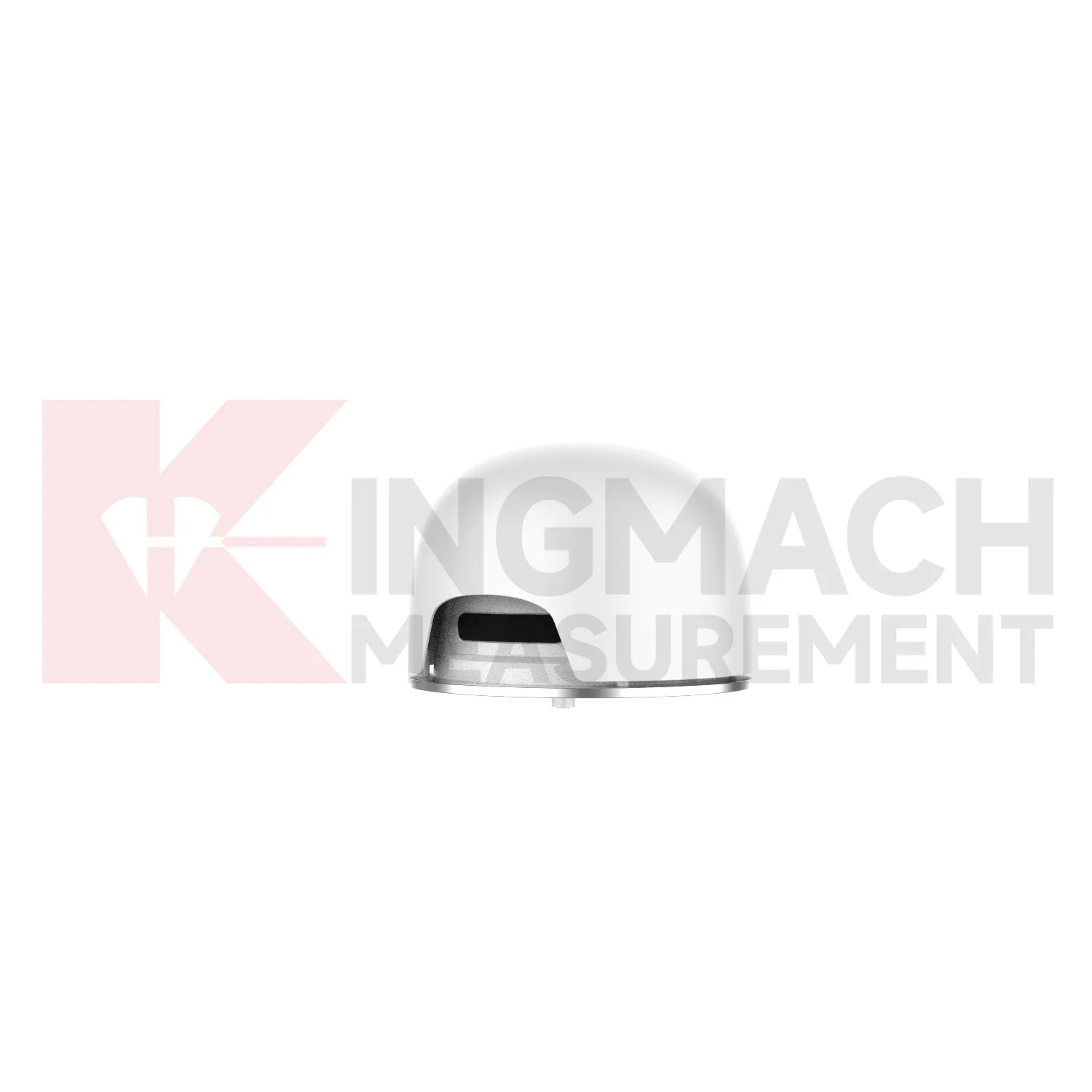
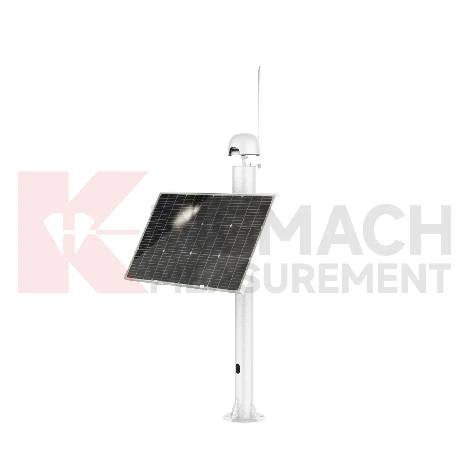
Integrated GNSS
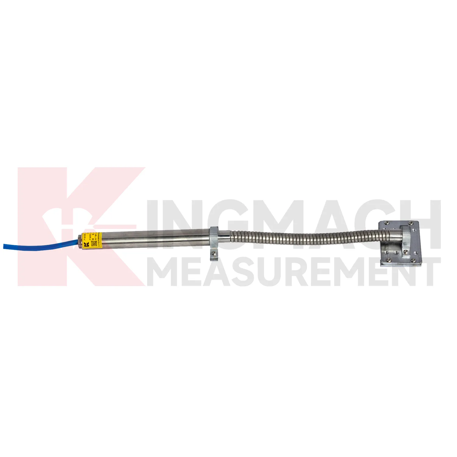
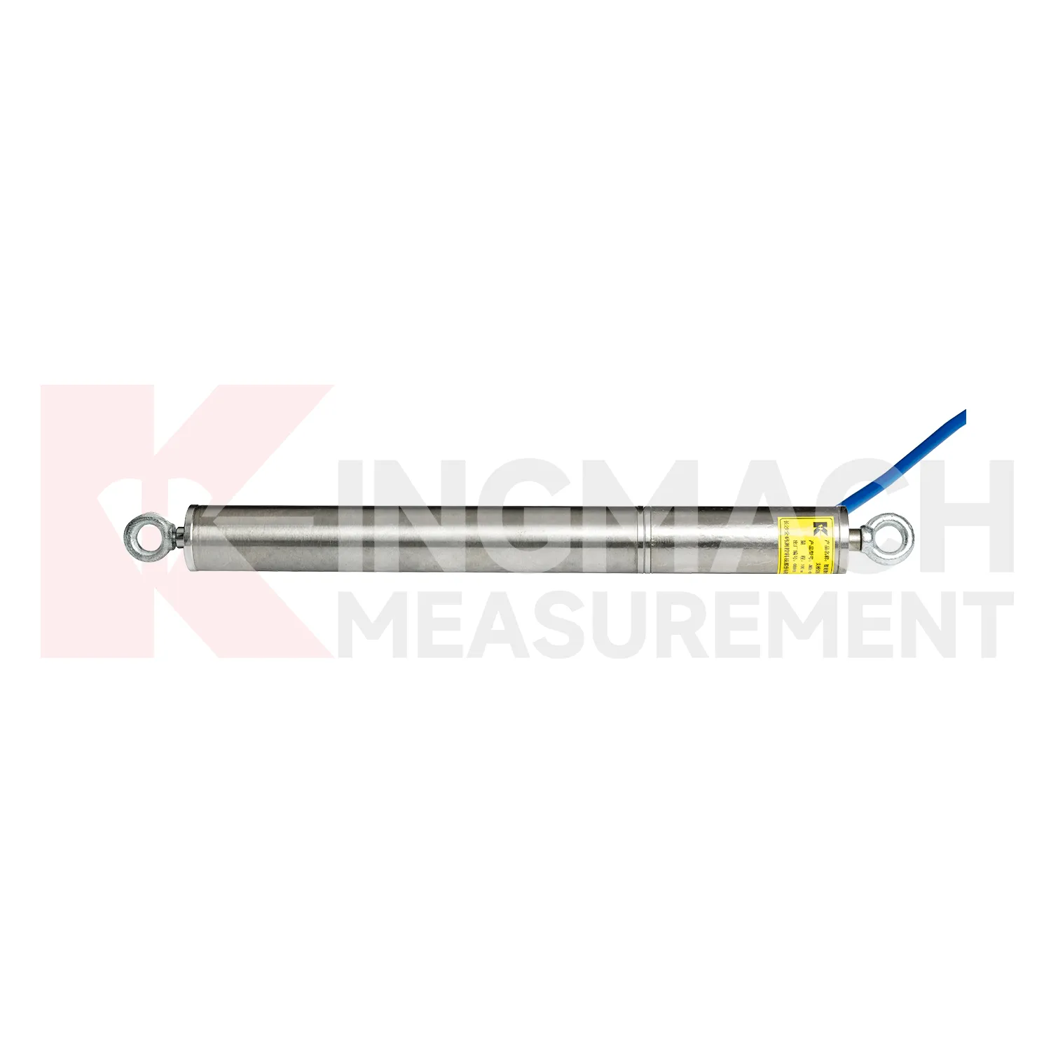
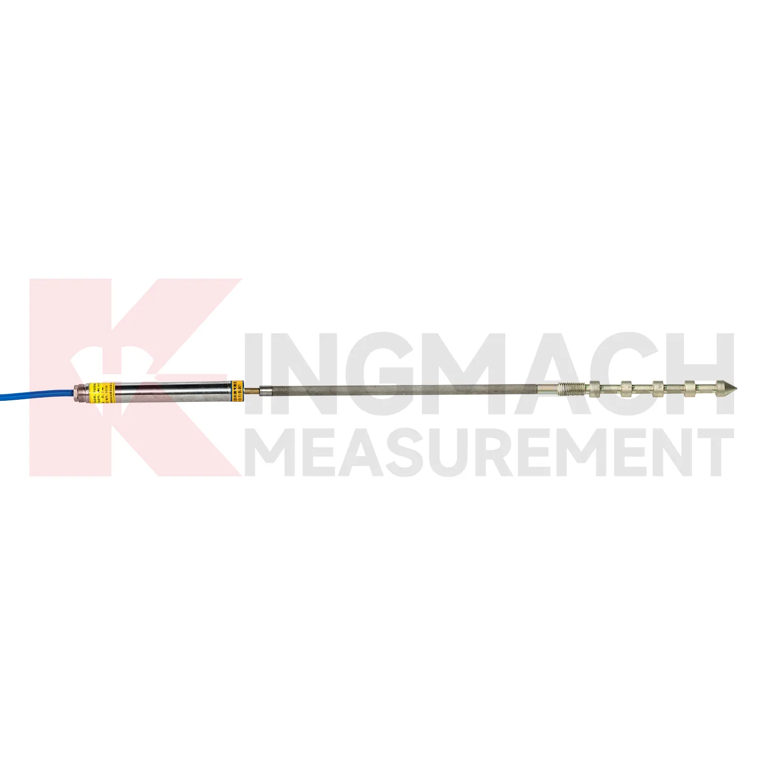
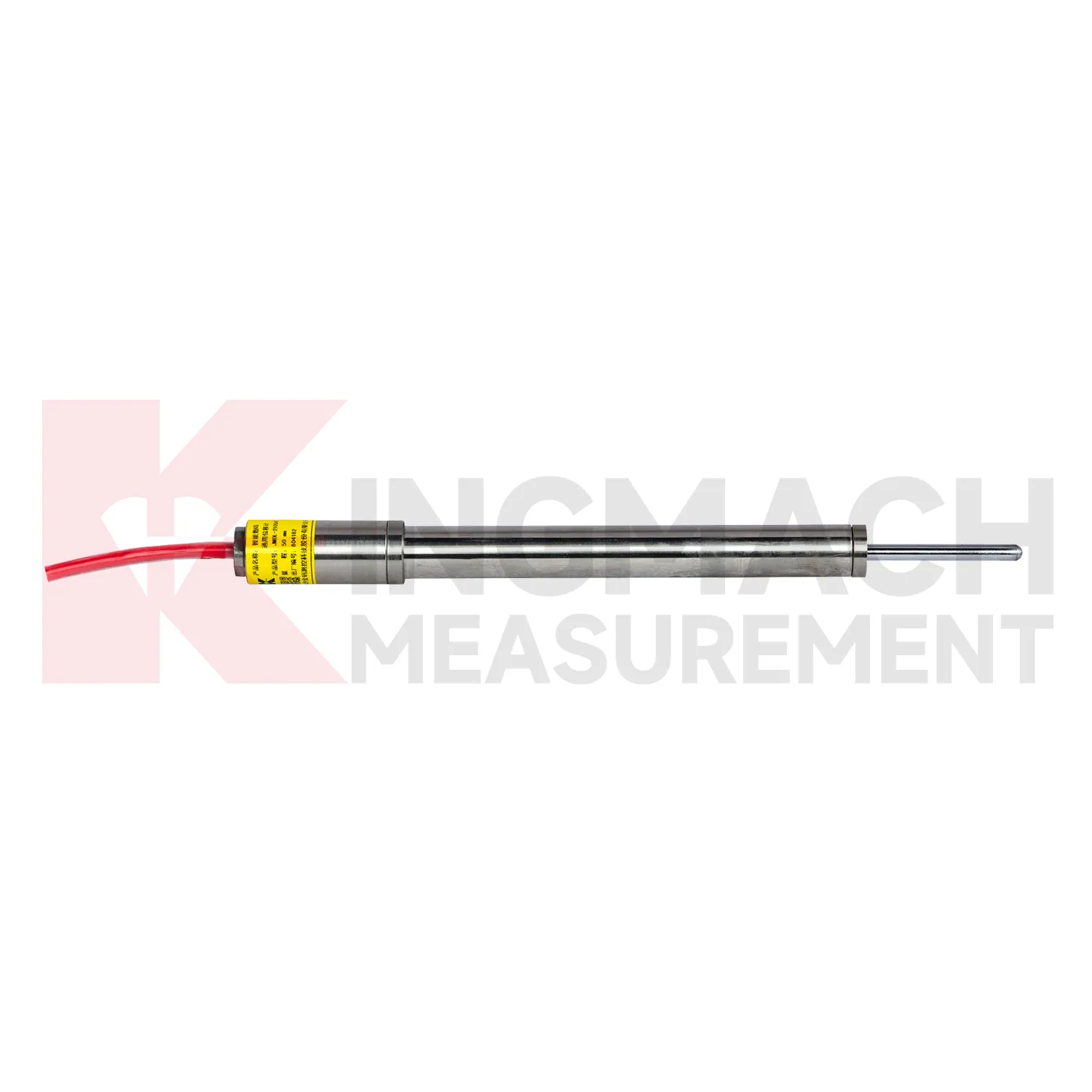
Kingmach Integrated GNSS include the JMDL-21XXAT Smart General-Purpose Displacement Meter, a compact instrument for relative displacement and expansion joint movement. The product is used in buildings, railways, transportation works, hydropower structures, dams, and bridge projects where two structural components may move against one another. Listed ranges include 50 mm and 100 mm, with 0.01 mm resolution and 0.5%FS accuracy. The meter is based on inductive frequency modulation, which supports high sensitivity, stable long-term observation, and low temperature influence. A built-in memory chip stores sensor model, serial number, calibration coefficient, time, temperature data for temperature versions, absolute displacement, relative displacement, and zero-point value. It can save 800 measurement results, which is useful when checking site history after construction stages or weather events. When connected to an integrated tester or automatic acquisition system, readings can be reviewed quickly without relying on manual gauge notes. During project setup, the measuring point should be matched with the expected travel direction, available mounting space, cable route, and required acquisition interval. This prevents a short-range joint instrument from being used on a long-travel point, or an exposed sensor from being placed where an embedded anchor is needed. It also helps the monitoring team set a baseline that can be defended during acceptance and later maintenance review.
Application of Integrated GNSS
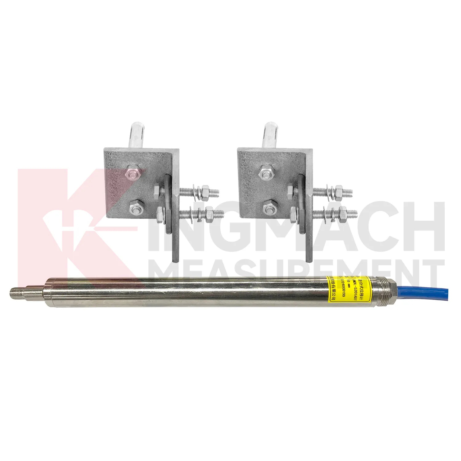
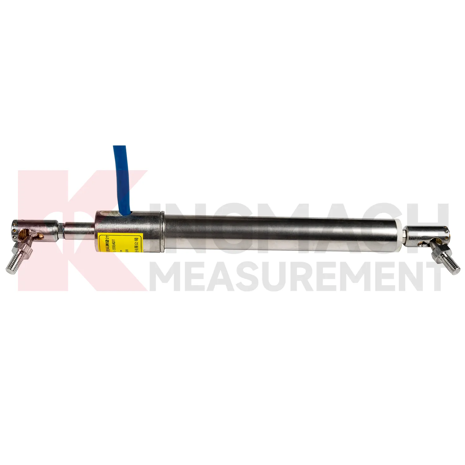
In tunnel engineering, Integrated GNSS help monitor surrounding rock deformation, lining movement, tunnel portal displacement, clearance change, and crack opening after excavation. Tunnel sites often have wet air, dust, restricted access, and changing support stages, so the instrument must hold a stable baseline through construction disturbance. Kingmach JMDL-31XXAT multipoint displacement meters use drilling and grouting with anchor heads at different depths, allowing engineers to compare the movement of separate rock layers. The series lists 50 mm, 100 mm, and 200 mm ranges with 0.01 mm resolution. JMDL-32XXAT single-point bedrock meters can be embedded with a flange, tie rod, anchor head, and PVC pipe assembly. JMLS-22XXADT wire rope sensors can watch longer displacement paths or tunnel wall clearances. These readings help site teams decide whether deformation is responding to excavation sequence, groundwater, lining timing, nearby blasting, or long-term ground pressure. During operation, the monitoring team should keep the baseline, temperature, inspection notes, and nearby sensor behavior in the same review file. This makes it easier to tell whether a movement trend comes from normal service, a repair event, changing load, water influence, or developing structural risk. Clear records also help owners decide when a field inspection is needed instead of waiting for visible damage.
The future of Integrated GNSS
Longer service life will be a major future requirement for Integrated GNSS. Infrastructure owners want monitoring systems that remain useful beyond the construction phase and into operation, inspection, repair, and renewal. Kingmach lists 30-year designed service life on selected products such as the JMDL-24XXAT flexible displacement meter and JMDL-49XXAT formwork displacement meter, while models such as JMCW-21XXADT use non-contact sensing to avoid mechanical wear. Future specifications will likely ask more directly about waterproof rating, connector durability, cable route protection, sensor replacement access, and data continuity after maintenance. For dams, bridges, railways, slopes, and tunnels, a displacement record over several years is often more useful than a short burst of high-frequency data. This long view supports asset management and helps distinguish slow structural change from normal seasonal movement. The next improvement will be planned service records: expected inspection intervals, spare part notes, replacement dates, and clear links between old and new baselines after a sensor is changed.
Care & Maintenance of Integrated GNSS
For draw-wire Integrated GNSS, the cable path is the part that most often decides data quality. Kingmach JMLS-22XXADT wire rope sensors use a plastic-coated stainless steel cable, spool, precision rotary sensor, RS485 communication, IP67 sealing, and ranges up to 2000 mm. During installation, align the cable with the expected movement direction, keep the pull smooth, and avoid rubbing against concrete edges, steel corners, temporary supports, or moving machinery. Do not overextend the cable beyond its range, and do not let it snap back during inspection. Check the anchor point, cable coating, spool movement, connector sealing, and lightning protection after storms or heavy site work. For long-term dam, tunnel, slope, or machinery monitoring, include cable tension and cable path photos in routine maintenance records. A clean cable route gives more reliable displacement data than any later software correction. Keep the installation photo, point number, zero value, and expected movement direction with the commissioning record for later review. If a reading changes after maintenance work, inspect the base, anchor, cable, and cabinet before assuming the structure itself has moved.
Kingmach Integrated GNSS
In structural monitoring, Integrated GNSS should not be treated as single-purpose accessories. Kingmach displacement products can work with comprehensive testers, automatic acquisition systems, bus modules, RS485 output, and monitoring software, which allows movement data to sit beside strain, load, settlement, tilt, vibration, temperature, and water level. That combined view is important because displacement often has several causes. A tunnel crown reading may respond to excavation sequence, groundwater, lining age, or nearby traffic. A bridge joint may move with both temperature and bearing behavior. A slope reading may change after rainfall, blasting, or retaining wall loading. By using smart products with stored parameters and digital transmission, project teams reduce channel mix-ups and make later data review cleaner. The result is a monitoring chain where field installation, sensor identity, baseline readings, and platform curves can be checked against one another. The point should be named on the drawing, linked with its cable route, and checked against the expected movement direction before the first automatic reading is accepted. For daily review, the reading should be compared with nearby points, recent weather, site operations, and any loading event that could explain the movement.
FAQ
Q: Which Integrated GNSS are used for rock layers or bedrock?
A: JMDL-31XXAT multipoint meters are used for different surrounding rock layers, while JMDL-32XXAT single-point bedrock meters are used for tunnel rock mass, dam bedrock, slope, or foundation pit movement.
Q: How many points can the multipoint meter support?
A: The multipoint installation kit supports three to five monitoring points, with anchor heads fixed at different depths by drilling and grouting.
Q: What ranges are listed for these models?
A: Both JMDL-31XXAT and JMDL-32XXAT list 50 mm, 100 mm, and 200 mm models with 0.01 mm resolution.
Q: Why monitor several depths?
A: Different layers may move differently. Separating shallow and deep movement helps engineers judge whether the problem is surface creep, deeper rock slip, or overall mass movement.
Q: What records should be kept?
A: Keep drilling depth, anchor location, grouting date, channel name, zero value, cable route, and first stable reading.
Reviews
Christopher Martinez
Very satisfied with the readouts & data loggers. User-friendly interface and supports multiple sensor inputs.
Daniel Brown
Excellent environmental monitoring sensors. The data is consistent, and the system integrates smoothly with our existing setup.
Latest Inquiries
To protect the privacy of our buyers, only public service email domains like Gmail, Yahoo, and MSN will be displayed. Additionally, only a limited portion of the inquiry content will be shown.
Harper***@gmail.comIndia
Dear Sir, we are planning to procure a complete monitoring system including strain gauges, tiltmeter...
Evelyn***@gmail.comSouth Africa
Hi, we are a contractor working on tunnel construction and need settlement sensors and displacement ...
Related product categories
- displacement sensor
- laser displacement sensor
- displacement sensors
- linear displacement sensor
- optical displacement sensor
- wireless displacement sensor
- laser displacement sensors
- non contact displacement sensor
- cable displacement sensor
- draw wire displacement sensor
- inductive displacement sensor
- lvdt displacement sensor